


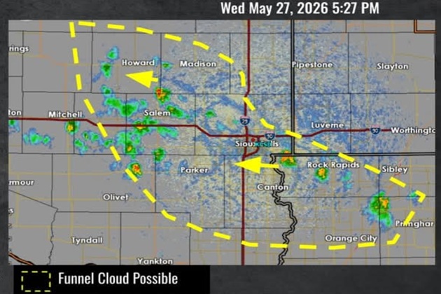

MITCHELL, SD (Mitchell Now) — An unexpected chance of severe weather cropped up late Wednesday afternoon, forcing people in the area to keep their eyes to the skies.
At 4:55 p.m., the National Weather Service Sioux Falls Office posted on social media that a cluster of showers and storms had developed near the Minnesota border and were moving west across Minnehaha and McCook Counties. Meteorologists initially believed the storms would not be severe but cautioned they could produce bursts of rain and up to 45 mph wind gusts.
At 5:30 p.m., the office sent out an update saying that funnel clouds and land spouts were both possible. A landspout is a tornado that exists away from a parent thunderstorm. Without the rotation visible on radar, it is nearly impossible to detect landspouts without a confirmed weather spotter observing them. Landspouts tend to be weak and don’t last long, but they still pack enough punch when they hit to be a threat to lives and property.
Mitchell saw just the occasional spit of rain from brief, but thick clouds. As of Thursday morning, no severe weather cases had been confirmed. Heading into the weekend, the forecast has chances of rain or thunderstorms at under 50% each day.