
MITCHELL, SD (Mitchell Now) — The National Weather Service in Sioux Falls has issued a heat advisory Tuesday for cities from the Interstate 90 corridor to the south from 1:00 p.m. to 9:00 p.m. Meteorologists are also warning about the possibility of severe thunderstorms overnight.
Heat indices are expected to peak in either the 4:00 or 5:00 p.m. hours across the region. It will likely feel like 101 degrees in Mitchell at its worst, with Vermillion baking to the tune of 103 degrees and Yankton expected to touch 104°.
NWS suggests adjusting the amount of time spent outdoors. For those who must be outside, wear light, reflective clothing, take frequent breaks indoors with the air conditioning going, drink plenty of water, and be extra vigilant against any signs of heat illness. Lastly, do not leave kids or pets inside a car as temps will quickly jump another 10 to 20 degrees in the cabin compared to the already scorching conditions outside.
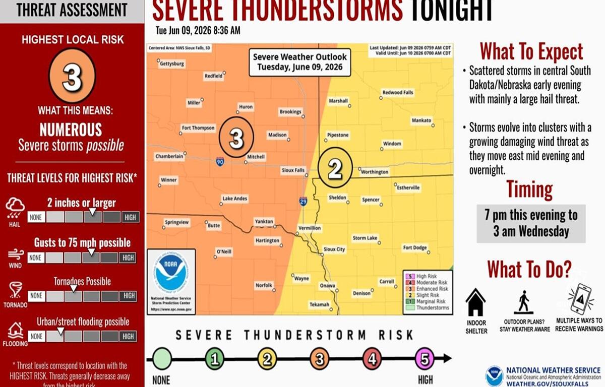
Severe thunderstorms will also likely rumble through the area between 7:00 p.m. and 3:00 a.m. Wednesday. No tornados are expected, but hail at least two inches in diameter and 75 mile per hour wind gusts are on the table. Some flash flooding on roads or in urban areas is possible.
For those with outside plans, they should keep an eye to the sky, have a phone or weather radio that can give them alerts, and stick close to an indoor shelter space, in case it is needed.