
MITCHELL, SD (Mitchell Now) — The National Weather Service is warning of the chance for severe thunderstorms, and even an isolated tornado, on Thursday.
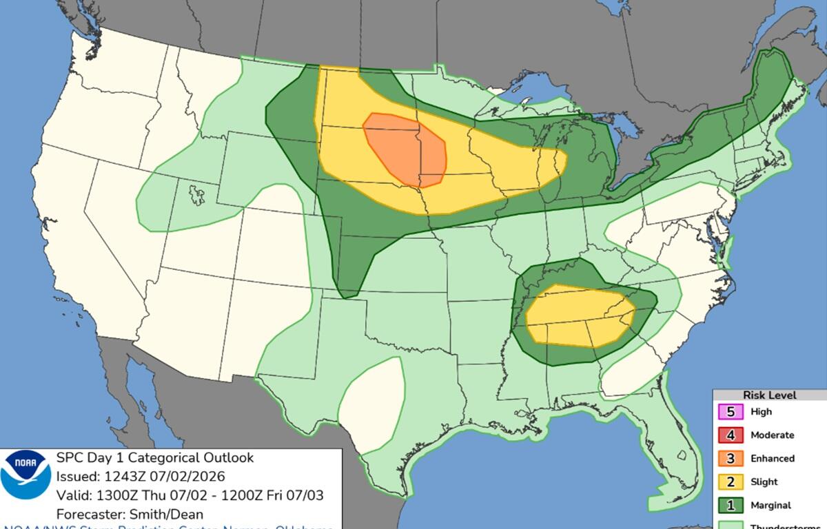
The current convective outlook from the NWS Storm Prediction Center shows eastern South Dakota in the enhanced risk zone, which is the third tier on a five-stage scale. A weak low pressure system will come in from the Black Hills, colliding with hot, humid air already in place over the region. That should lead to strong instability in the atmosphere.
If the storms break out this evening, forecasters expect them to bring drenching rain and winds up to 75 miles per hour. Inside supercells, hail up to two inches in diameter is not out of the question. If the storms can get organized earlier in the afternoon during the heat of the day, an isolated tornado is possible.
There is also a slight risk for excessive rainfall across all of southeast South Dakota, which could lead to localized flooding. Anyone living or camping in flood-prone areas should be vigilant through the weekend. More storms are possible late Friday and sometimes there is a delay between when the heaviest rains occur and when rivers or creeks crest.